Article re-cap
- The South African Weather Service has issued a Yellow Level 4 warning for Cape Town due to heavy rain and strong winds.
- Rainfall accumulations in the City of Cape Town districts could reach between 30mm and 60mm.
- A Yellow Level 2 warning for strong winds is in effect for parts of the Western Cape, which may impact high sided vehicles.
- Rough sea conditions are expected from Cape Columbine to Cape Agulhas, potentially affecting smaller fishing vessels.
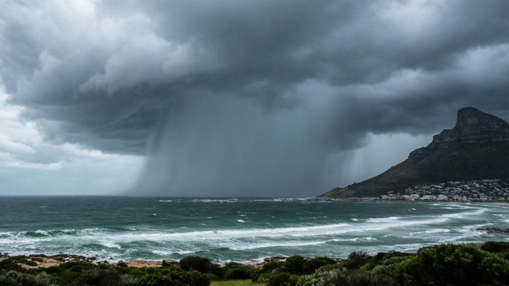
The South African Weather Service has issued a Yellow Level 4 warning for Cape Town as a powerful cold front brings heavy rain and strong winds to the Western Cape.
The City’s Disaster Risk Management Centre confirmed that a Yellow Level 4 warning for disruptive rainfall has been issued for large parts of the province. Officials are urging households to secure homes and remain alert for possible flooding and storm damage.
Rainfall accumulations of between 15mm and 25mm are expected in many areas, while the Cape Winelands and City of Cape Town districts could receive between 30mm and 60mm. Forecasts indicate widespread showers will first affect western areas before spreading east into Monday.
A Yellow Level 2 warning for strong winds has been issued for parts of the Western Cape and southern Namakwa, which may create dangerous conditions for trucks and high-sided vehicles on exposed routes. Motorists travelling along coastal roads and mountain passes have been urged to drive cautiously.
Rough sea conditions are expected between Cape Columbine and Cape Agulhas from Sunday into Monday, with a Yellow Level 2 warning issued for damaging waves. According to the report, these conditions could make navigation difficult for smaller vessels and fishing operations along the coastline.
Frequently asked questions
What is the current weather warning for Cape Town?
The South African Weather Service has issued a Yellow Level 4 warning for Cape Town. A powerful cold front is bringing heavy rain and strong winds to the region, with officials urging residents in Bloubergstrand and surrounding areas to remain alert for possible flooding and storm damage.
How much rain is expected in the Cape Town area?
While many areas will see accumulations between 15mm and 25mm, the City of Cape Town districts could receive between 30mm and 60mm. Widespread showers are forecast to affect western areas first before spreading east into Monday.
Are there any warnings for drivers in the Western Cape?
A Yellow Level 2 warning for strong winds has been issued for parts of the Western Cape. This may create dangerous conditions for trucks and high sided vehicles on exposed routes, so motorists travelling along coastal roads or mountain passes are urged to drive cautiously.
Will the weather affect sea conditions along the coast?
Yes, rough sea conditions are expected between Cape Columbine and Cape Agulhas from Sunday into Monday. A Yellow Level 2 warning for damaging waves has been issued, which could make navigation difficult for smaller vessels and fishing operations along the West Coast.
Source: capetownetc.com